New hydraulic modeling shows change in Well 15 service area
For most of the past year, Madison Water Utility has been working to develop new well service maps to reflect changes in the hydraulic operation of the City’s water system. Those changes include the construction of a new 1.3 million gallon water tower and large transmission main at Lake View Hill Park on the North side, a major upgrade of the Bunker Hill pump station near East Towne Mall, and the reconstruction of Well 7 on Sherman Avenue.
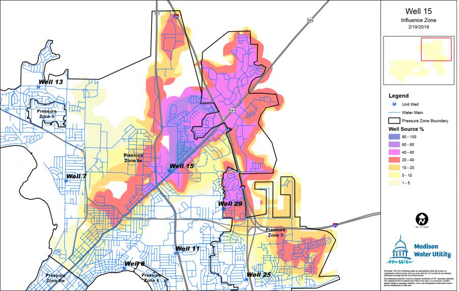
The revised map for Well 15 shows the well’s service area has decreased in the wake of those major projects, as has the number of people who are receiving 80-100% of their water from the well. Most people in the East Washington Ave. corridor are getting a blend of water from several wells. The map is meant to be an estimation of the service area of the well, averaging a range of operational conditions over the course of a year. Service areas for any well can change based on season, weather conditions (i.e. drought, heavy rainfall), loss of service at nearby wells, or other unforeseen changes in system operation.
New hydraulic modeling allows Madison Water Utility to develop a better picture of how its 23 wells located in 10 distinct pressure zones work together to supply water to the city. Previous maps were developed in 2013.
Contacts
- Media Inquiries: Amy Barrilleaux, Public Information Officer, (608) 266-9129, abarrilleaux@madisonwater.org